Cockburn Sound
The Department of Water and Environmental Regulation supports the management of other water bodies in addition to those supported by Healthy Estuaries WA. This includes Cockburn Sound, where the department monitors water quality at eight sites using automated instruments.
The department monitors water quality in Cockburn Sound using two types of instruments:
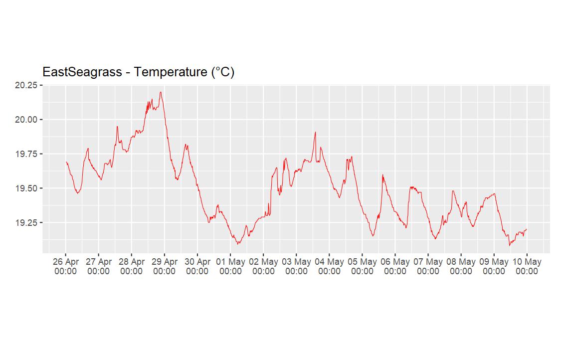
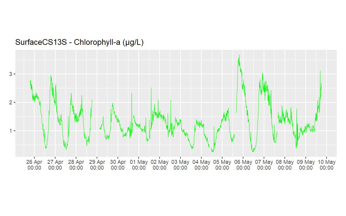
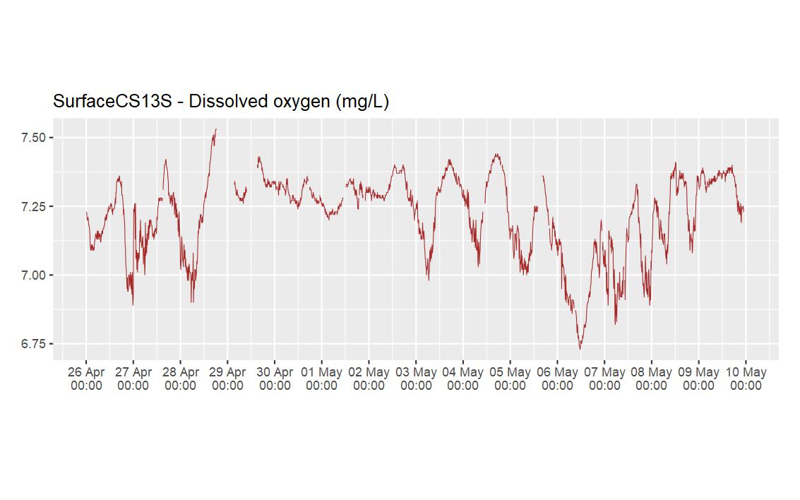
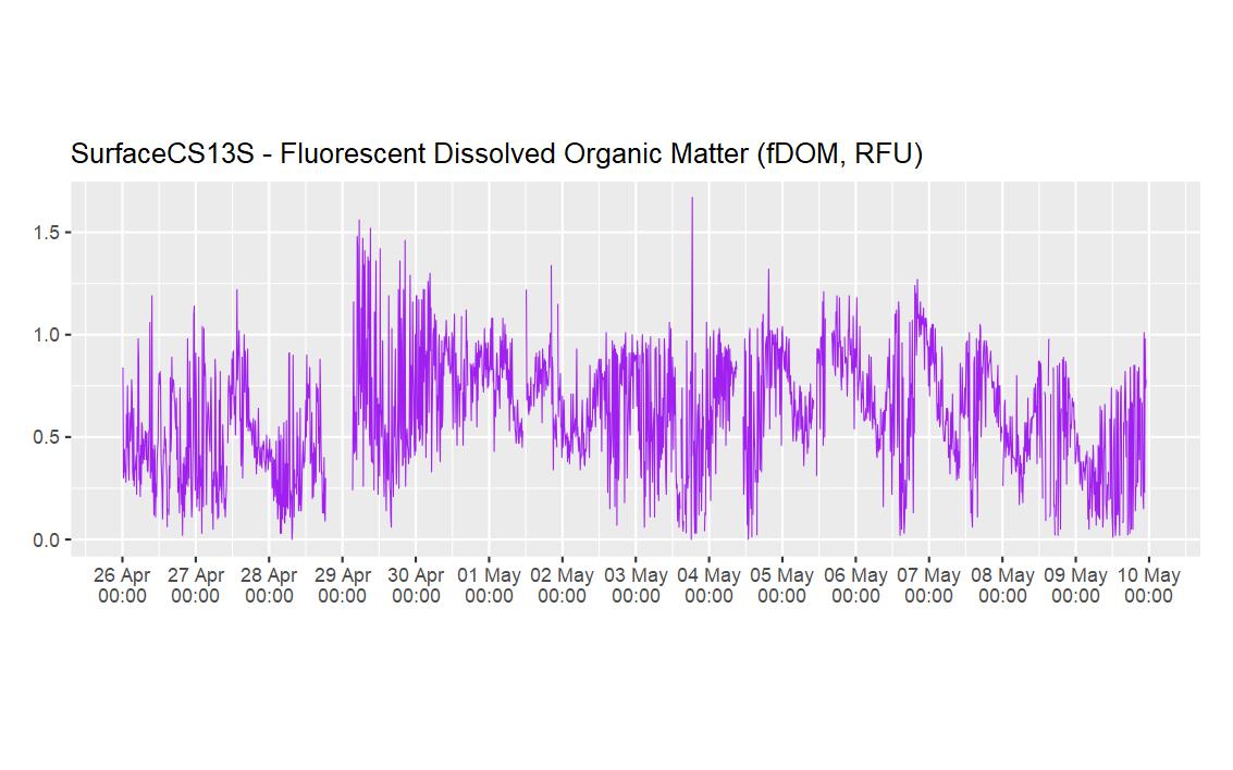
(a) EXO2-YSI has sensors that measure temperature, salinity, dissolved oxygen (DO), chlorophyll-a, and dissolved organic matter (fDOM), and
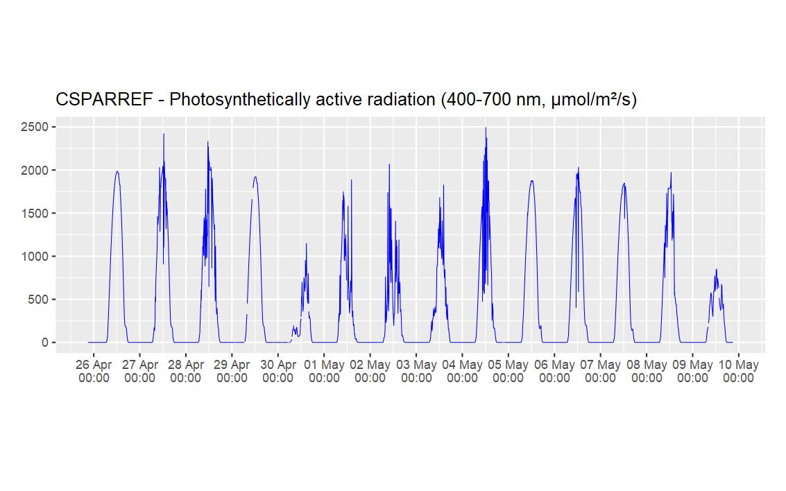
(b) MS9-In-situ Marine Optics has sensors that measure the light intensity at different wavelengths to determine photosynthetically active radiation (PAR).
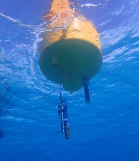
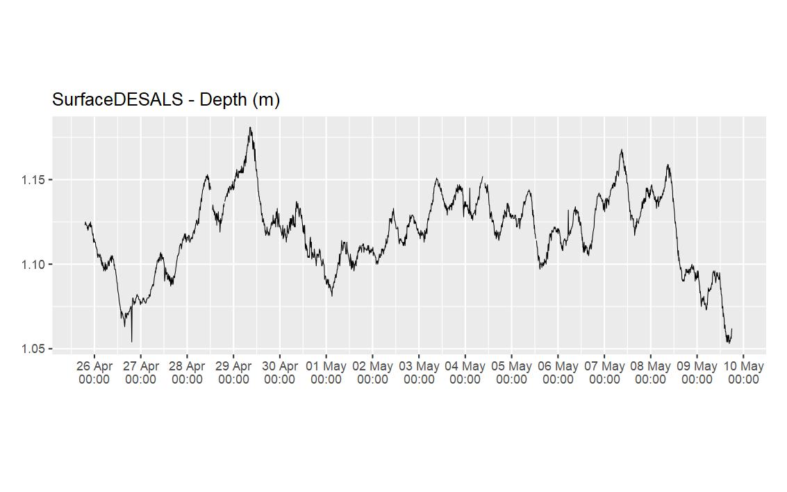
These instruments are mounted on a frame at the bottom of the sound and/or at the surface, attached to a moored buoy. For the deeper sites, surface and bottom instruments are in use, allowing a better characterisation of the water column. For shallow sites, only bottom instruments are usually used.
Simple data QC for data visualisation:
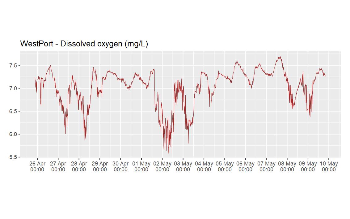
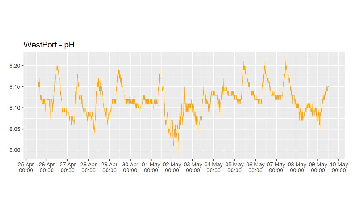
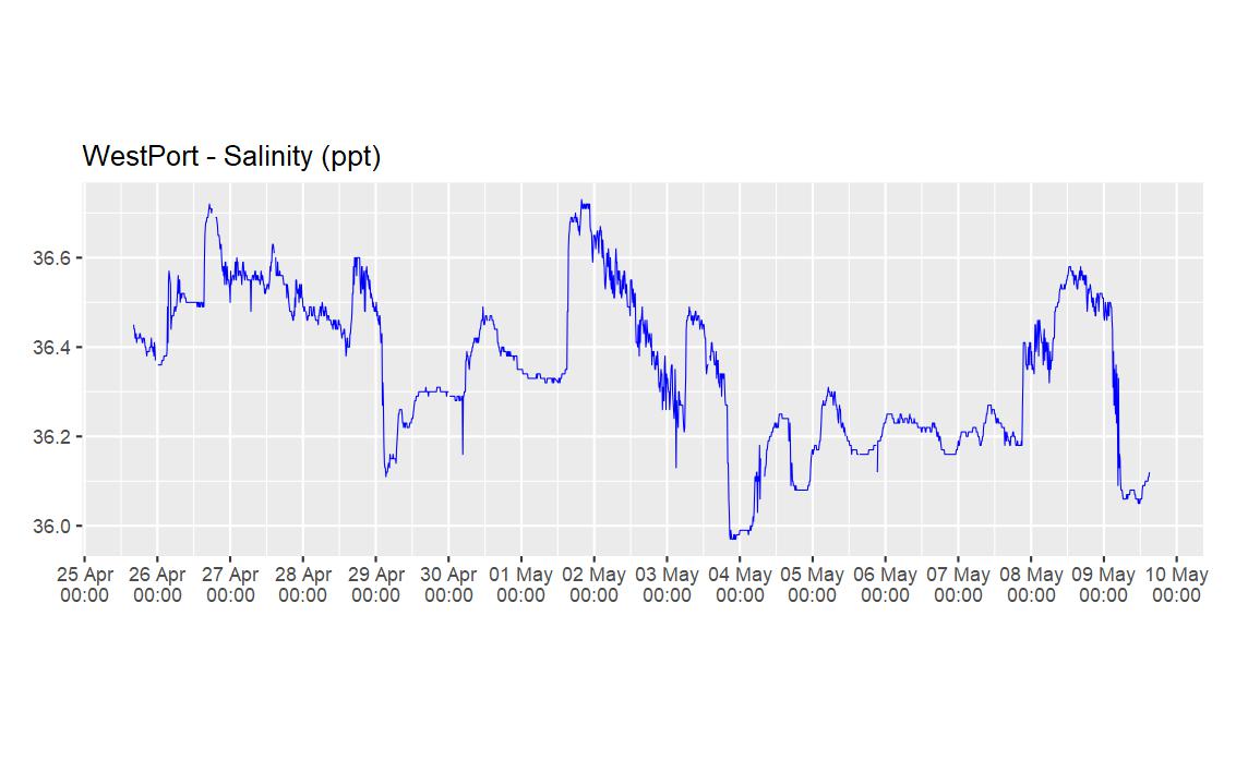
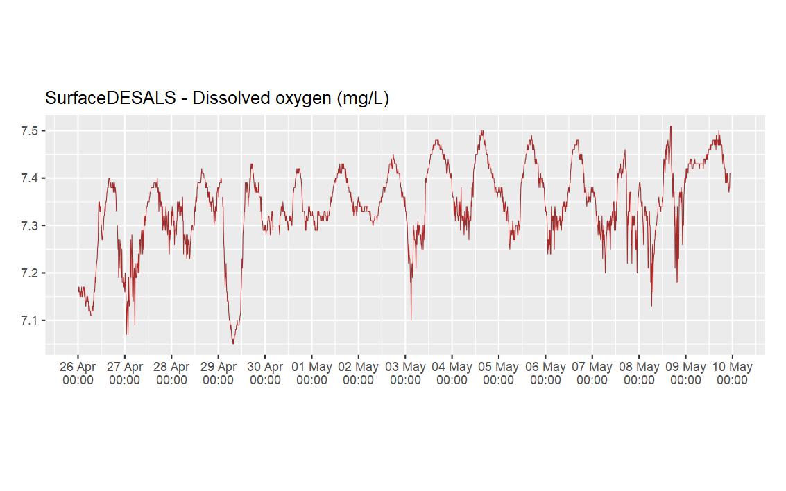
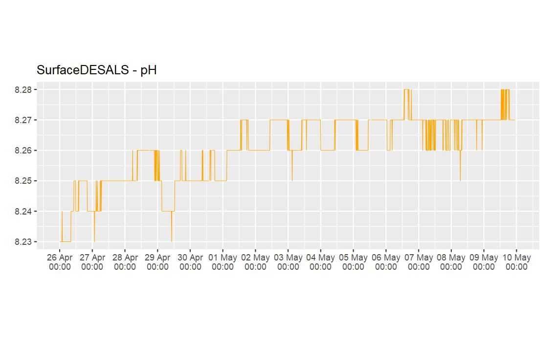
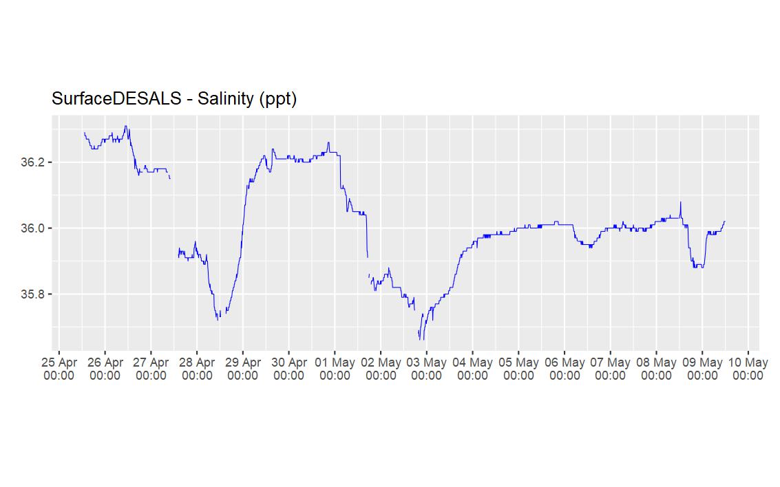
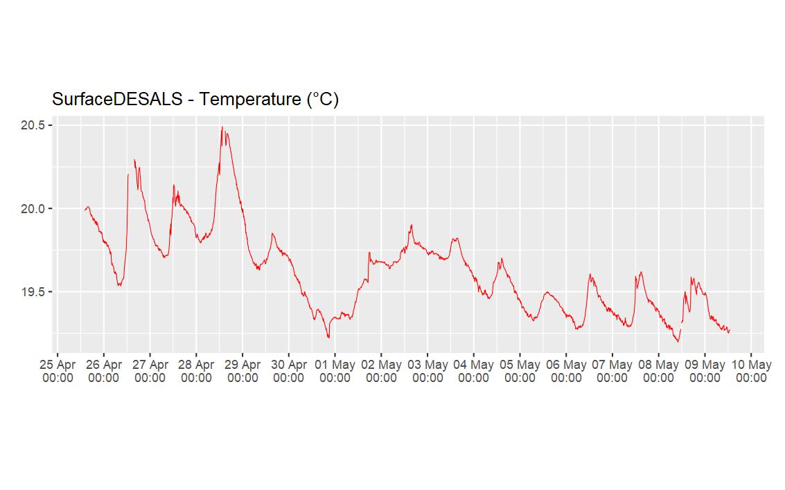
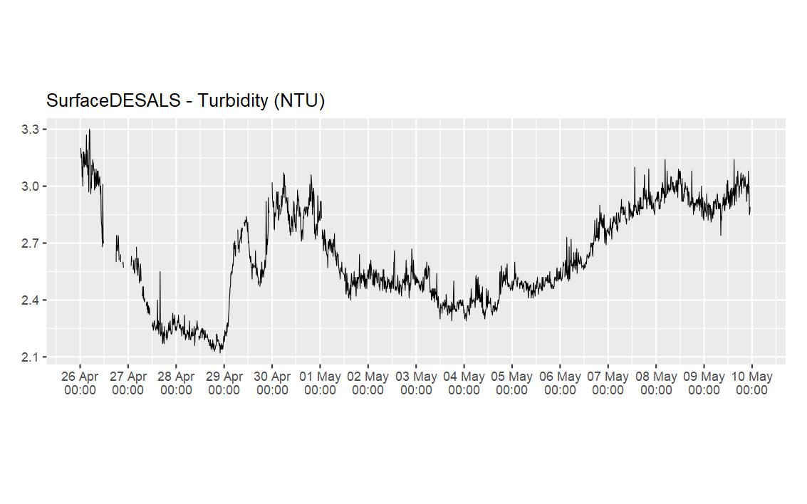
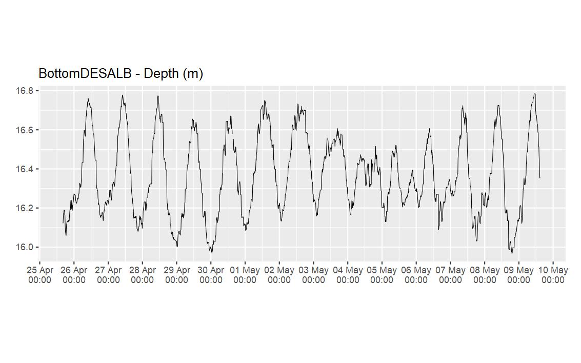
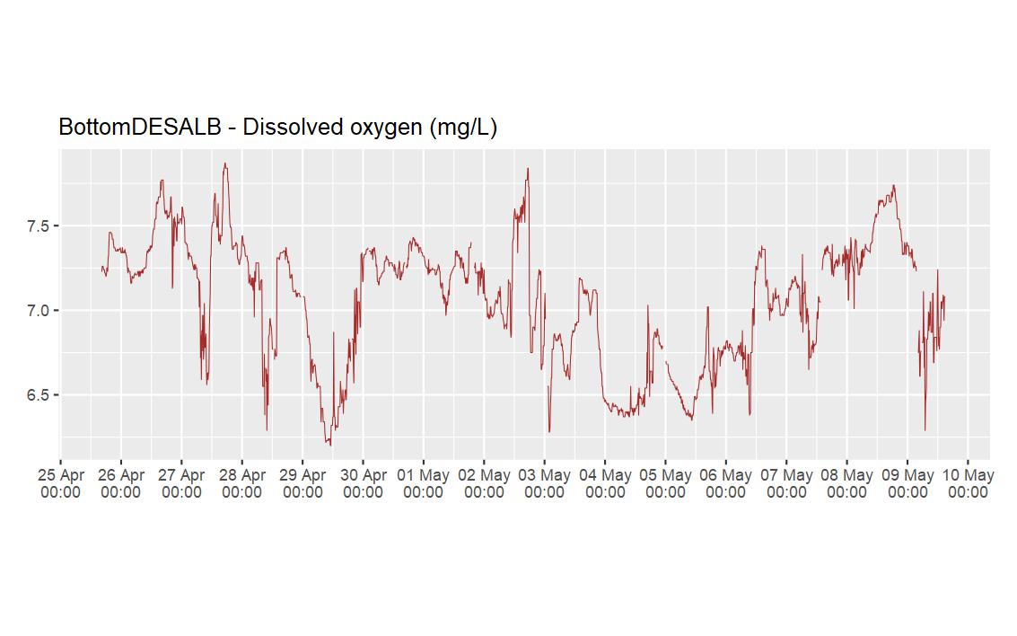
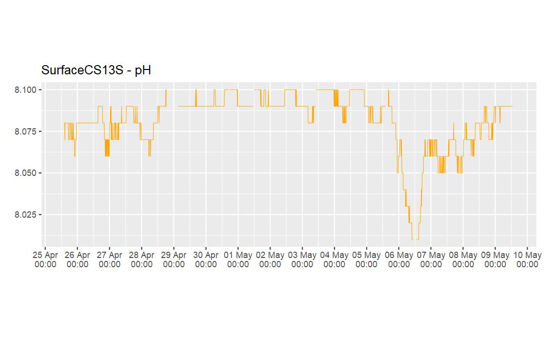
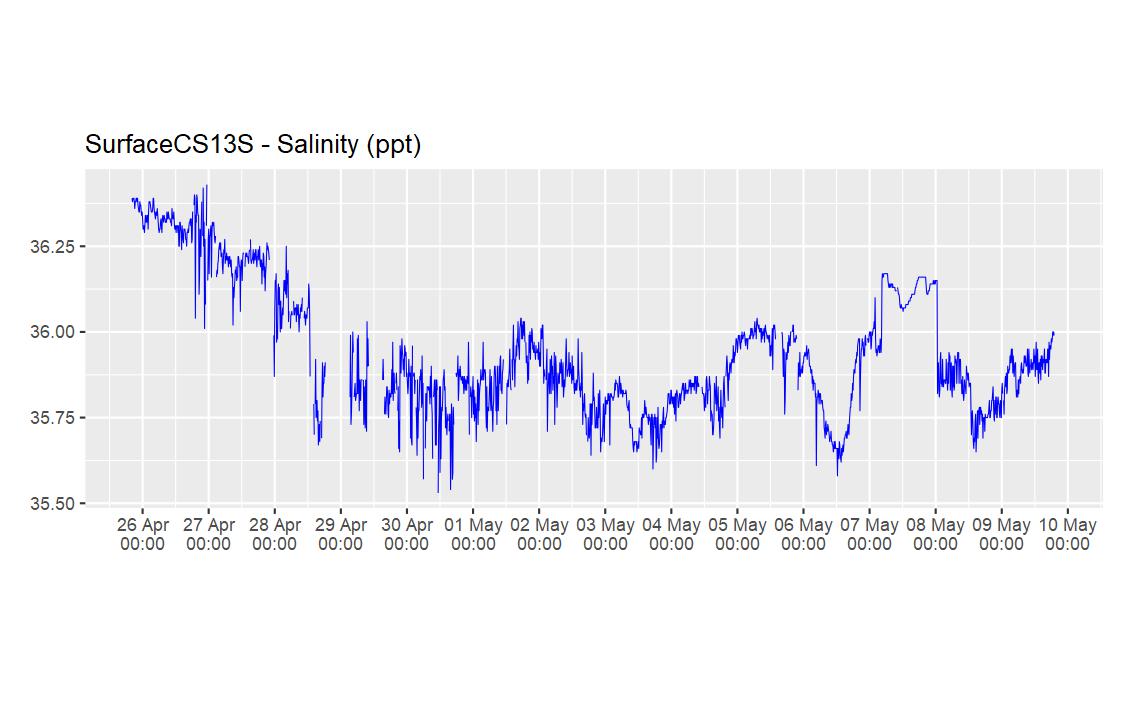
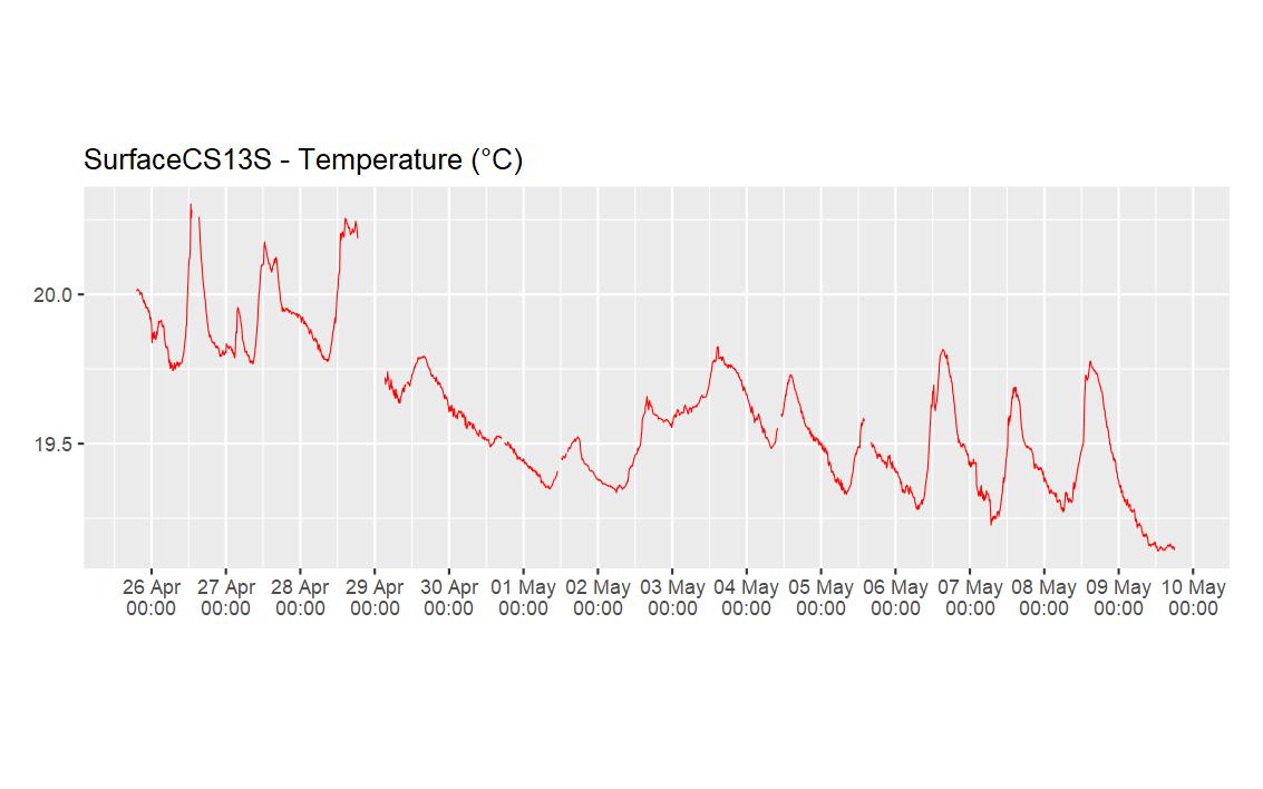
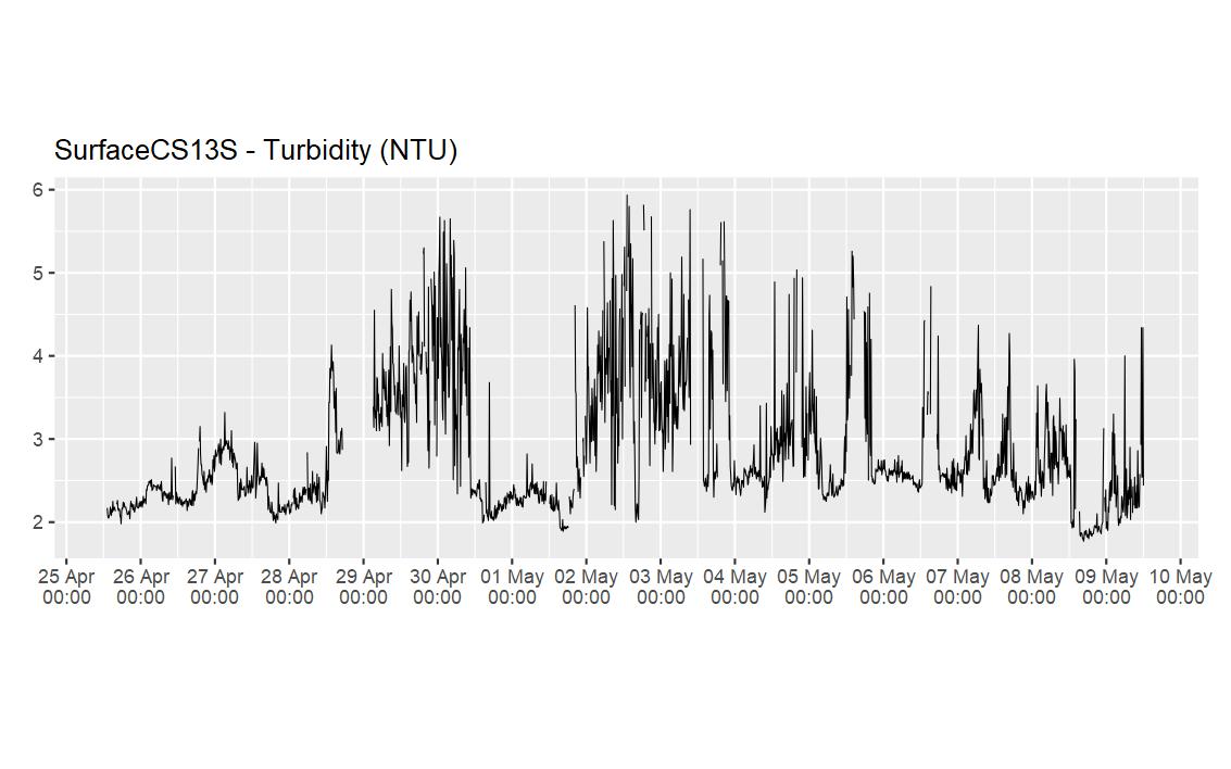
Data in the below visualisations have had outliers removed. These are data points when an underwater instrument is out of the water, or if a sensor is not functioning well.
Cockburn Sound Power Boat Ramp PAR Reference
North East - Garden Island Seagrass


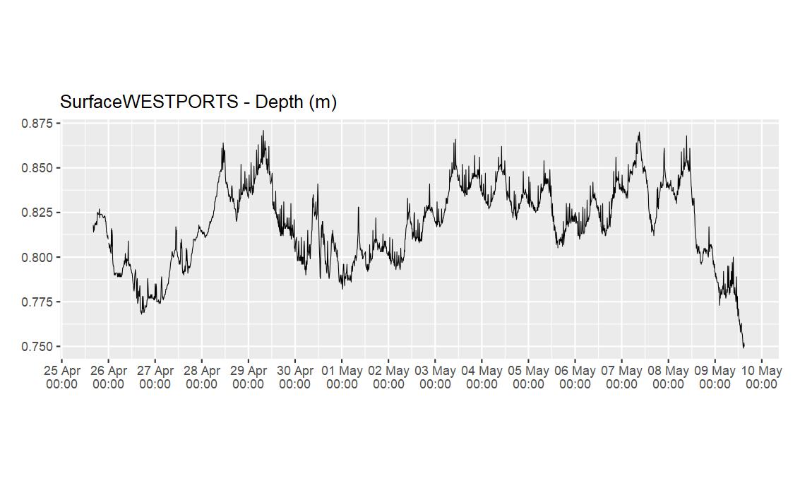
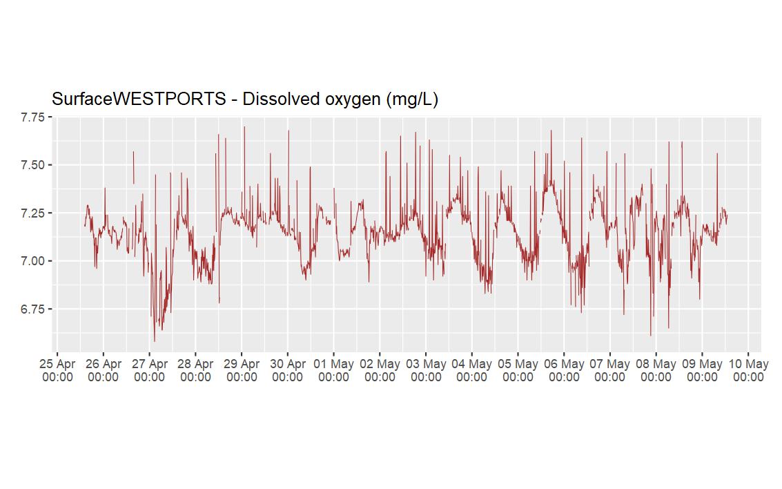
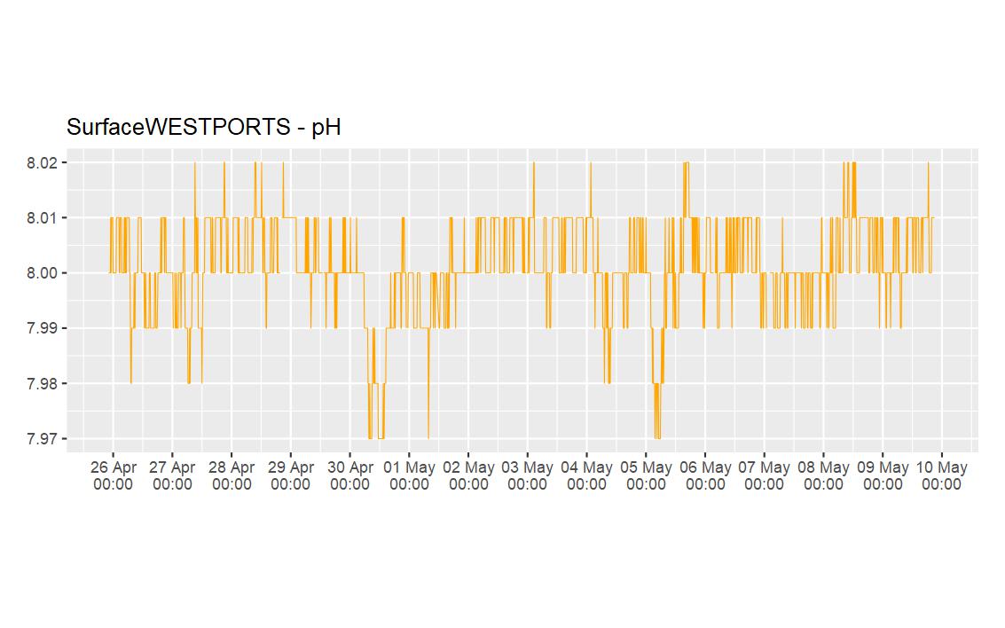
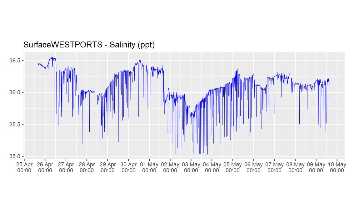
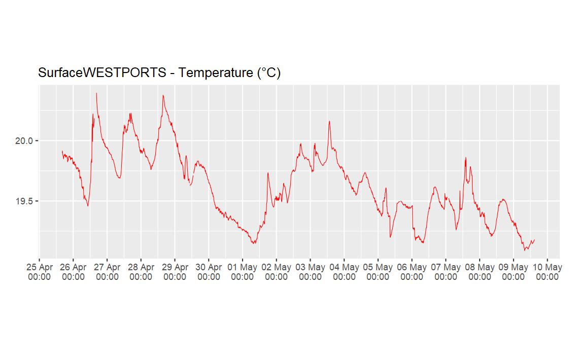
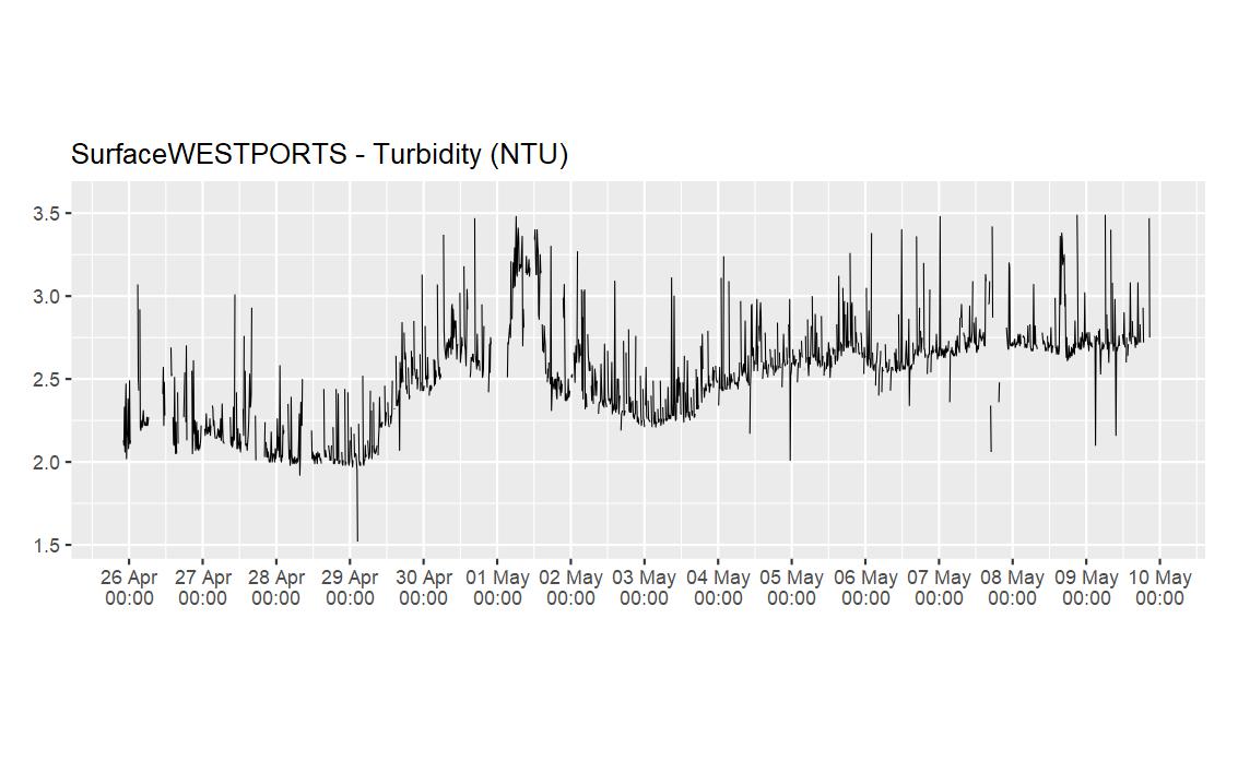
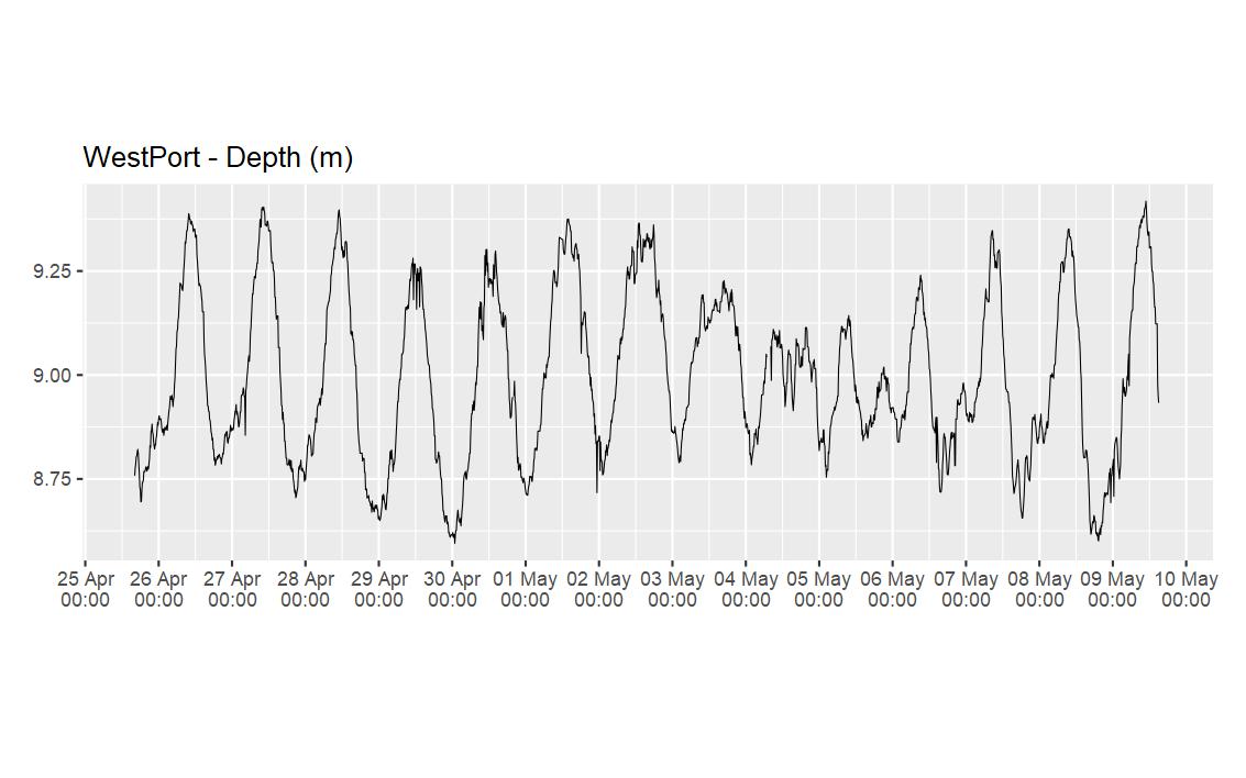
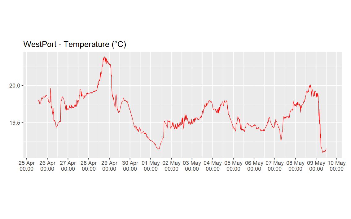
West Port
Surface (6140269)
Bottom (6147037)

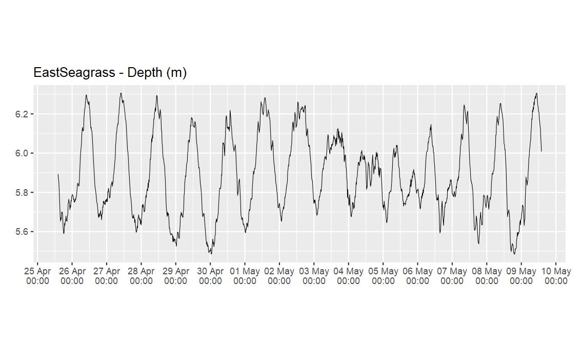
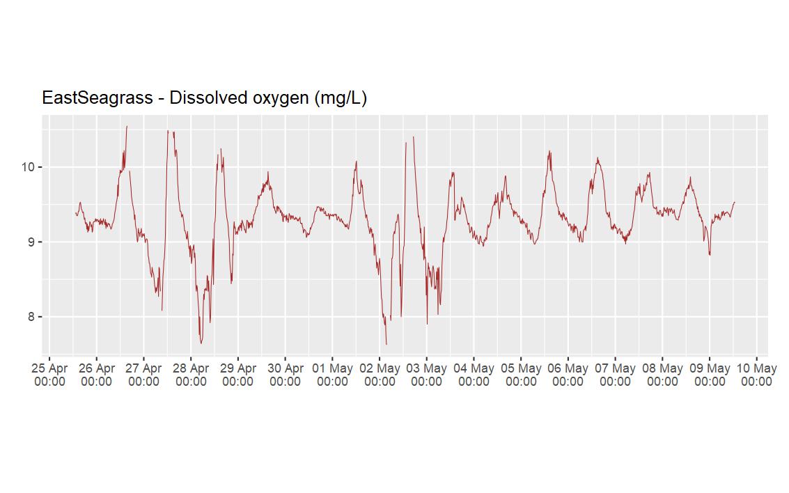
Eastern Margin Seagrass

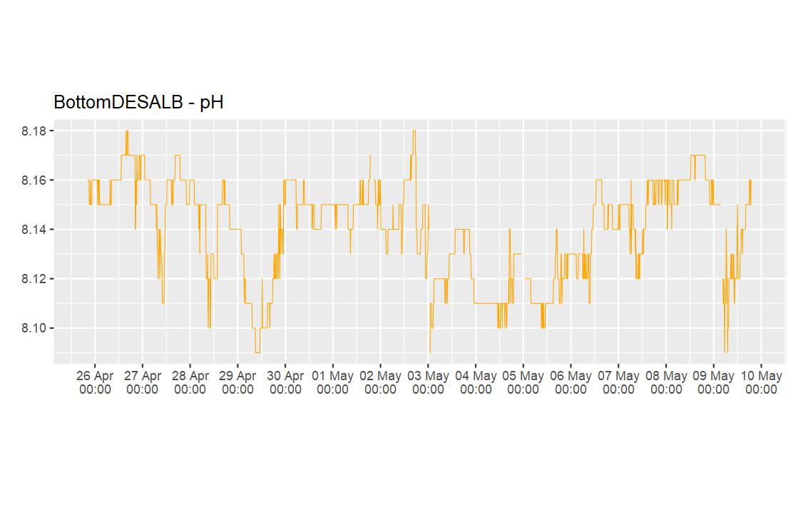
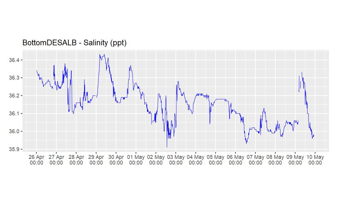
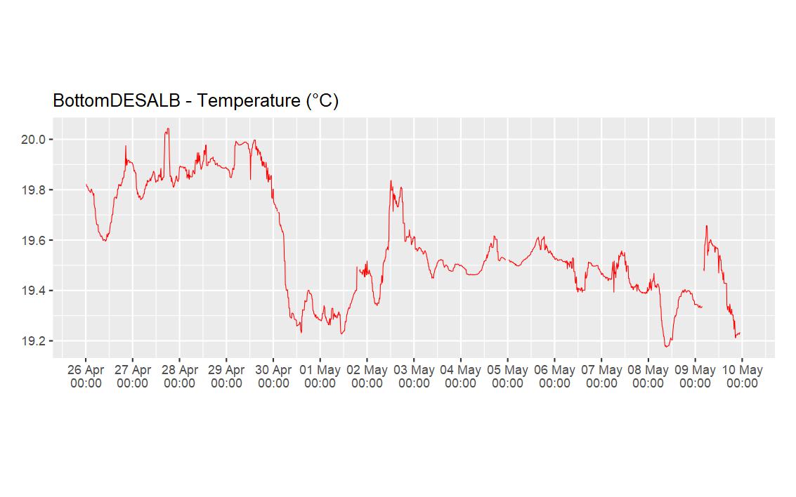
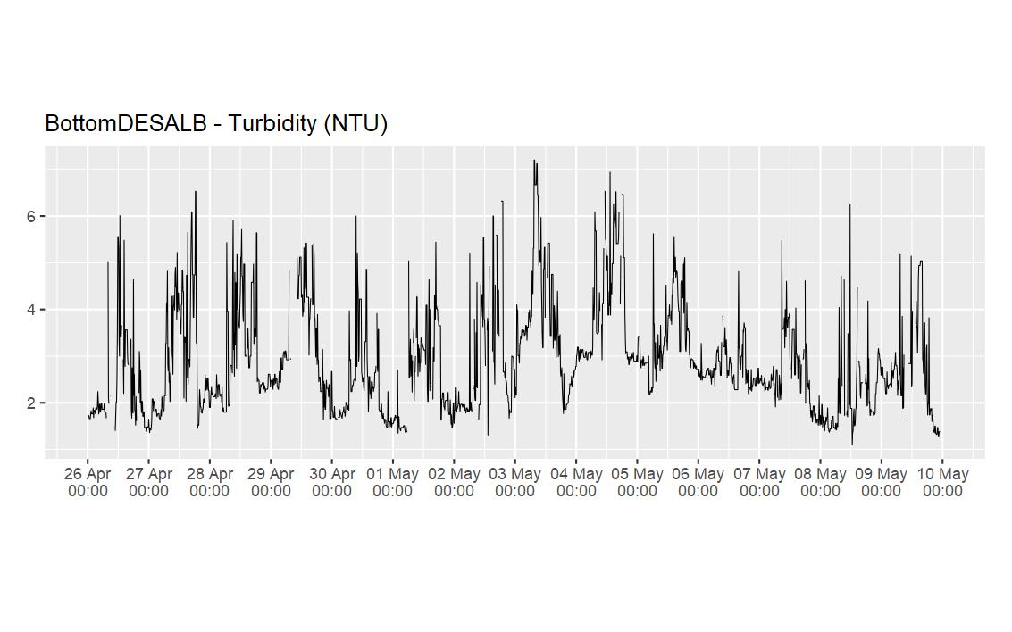
Desalination Plant
Surface (6140267)
Bottom (6140281)
South Cockburn Sound 13 - Surface

South Cockburn Sound 11 - Surface
Mangles Bay
MBT PAR Reference (6147038)

Bottom (6147033)