
Scientists from the Department of Water and Environmental Regulation took to the water and sky to monitor seagrass in Nullaki (Wilson Inlet) last month.
Caitlyn O’Dea, Environmental Officer from the department’s Aquatic Science Branch, is part of a team that monitors seagrass in estuaries across south-west Western Australia each summer.
Caitlyn said the team uses underwater cameras and viewing cones from a boat and kayaks on the water to observe the density and health of seagrass growing in the estuary.
“This gives an insight into the health of the estuary and potential threats to the ecosystem,” Caitlyn said.
In addition to these observations, the seagrass team uses drone technology to inform seagrass distribution maps in areas that are too shallow to access by boat.
“Seagrasses often grow in shallow water because the plants need sunlight to photosynthesize, creating oxygen and energy in the form of sugar,” Caitlyn explained. “If we skip these areas that we can’t always get to on the boat or on kayaks, we might underestimate how much area the seagrass covers.
“Using our drone, we take thousands of photos over many hectares of the estuary. Software can stitch these photos together to create a large aerial image which we can use to supplement the data we collect by boat.”
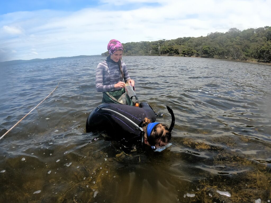
The team also gets in the water to collect samples of seagrass at eight sites across Nullaki, and processes these in the laboratory. This allows them to track the health of seagrass closely and build an understanding of why changes might be occurring.
Caitlyn said the team was pleased to record dense meadows in some parts of the estuary, including near the mouth of the estuary, at the Denmark River, near Karri Point and Morley Beach.
“It was also exciting to see the seagrasses flowering across most of the estuary, evident by the long pollen stalks reaching the surface and the tightly coiled flower stalks,” Caitlyn said.
“While first impressions look positive, recent surveys have shown that seagrass in the estuary is declining in some areas. Macroalgae (or seaweed) is also becoming more abundant, which can smother seagrasses and interfere with the reproductive cycle.”
Understanding seagrass condition guides management
This latest data collection activity, which took place in December, is part of an annual seagrass surveying program in Nullaki that is now entering its sixth year.
Dr Kieryn Kilminster, who leads the seagrass team at the department, said that mapping each year helped to build a holistic understanding of estuary health to inform management.
“Seagrasses need good water and sediment quality to thrive, which makes it a good indicator for estuarine health,” Kieryn said. “Seagrass condition can be affected by seasonal changes and environmental conditions, as well as the opening and closing of the sandbar at the mouth of the estuary.
“We have used the data collected across these multiple years to inform the new decision framework for opening the sandbar. In understanding how changes in climate in the region will alter the sandbar decisions, we seek to manage risks not only for seagrasses, but also for the broader ecological and social values of the inlet.
“In the coming months, we will be processing samples, compiling drone footage, and analysing the data.”
Data collected will feed into the department’s seagrass database and be used to publish snapshot reports of seagrass health and inform the ongoing management of the estuary.
The seagrass surveys are part of Healthy Estuaries WA, a State Government program that aims to improve the health of our South West estuaries.