Department of Water and Environmental Regulation (DWER) modellers are using OVERSEER, a New Zealand-based software, to examine the impact of different farm management practices on nutrient levels flowing into our waterways.
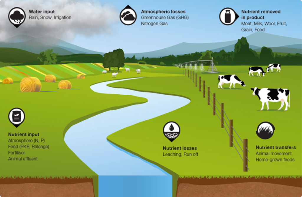
Catchment models calculate the nutrients entering waterways based on an understanding of drainage in the catchment and how different land uses contribute different amounts of nutrients. However, catchment-scale models are not designed to capture how management changes on individual farms impact nutrient levels.
For example, if every beef farmer in the catchment used the results of soil tests to calculate their fertiliser application rates (compared with applying a set rate every year), what quantity of nutrients would be prevented from entering waterways?
Joel Hall is one of the DWER modellers adapting OVERSEER to conditions found in Western Australia’s south-west.
“We’ve been working with OVERSEER over the last three years. We started by working with specialist consultants Eco Logical Australia, who assisted in adapting the farm-scale model using climate, soil, land-use, drainage and farm-management data from a case study in the Vasse-Geographe catchment,” Joel said.
This south-west WA version of OVERSEER was then applied to localised conditions in the Peel-Harvey and Wilson catchments to evaluate the effectiveness of farm-based best management practices.
This included the use of soil amendments, low-soluble phosphorus fertilisers, best-practice fertiliser management and soil testing.
“We used OVERSEER in combination with our catchment-scale models to estimate the phosphorus reductions to our south-west estuaries that have resulted from the fertiliser management program so far. We also used it to estimate the potential further reductions if these programs were rolled out at a broader scale, capturing all landholders,” Joel said.
“For example, the OVERSEER model and source-catchment model showed that, for the Vasse Geographe catchment, the best-practice fertiliser management and soil-testing program is estimated to have reduced the phosphorus input to Geographe Bay by an average of 1.9 tonne per year. The modelling indicates if this program were rolled out at a broader scale and all landholders in the Geographe catchment applied fertiliser according to the recommendations, it is possible to reduce the phosphorus load to the receiving water bodies by 6.5 tonne per year, or 20 per cent of the total load.”
The information gained from the combination of farm and catchment-scale models is validated using local data and literature, then used to inform Water Quality Improvement Plans which outline and prioritise on-ground actions to improve the health of our waterways.
Joel said that while the work being undertaken throughout the past three years of the Regional Estuaries Initiative was very exciting, there was still more to be done to refine the models further through the Healthy Estauries WA project.
“In the future we hope to use more local data to further validate OVERSEER for WA conditions,” he said.
“We hope to eventually extend its use to non-grazing properties, including orchards, vines and horticulture, and to provide more sophisticated links between the farm and catchment-scale models.”