The Regional Estuaries Initiative supported the ongoing water quality, seagrass and macroalgae monitoring of the Hardy Inlet since 2016 with monitoring continuing through Healthy Estuaries WA.
Below is the latest data about the condition of Hardy Inlet.
Water quality in Hardy Inlet 2021-22
Rainfall and river flows in winter 2021 were higher than recent averages. Although it was a wetter winter than other recent years, it was not as high as high-flow years before the 2000s because rainfall is declining over time.
Overall, the water quality in the estuary was good throughout 2021–22, although there were occasionally high nutrient concentrations in certain areas, especially Scott River and Molloy Island.
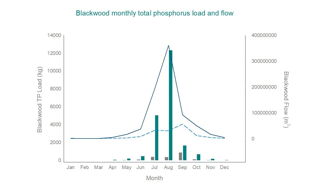
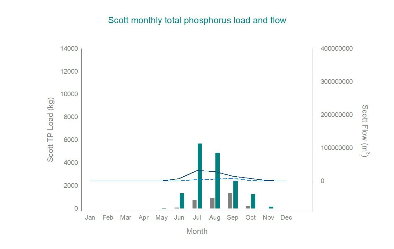
Two main catchments flow into the Hardy Inlet – the Blackwood and the Scott catchments. Although the Scott catchment is smaller in size than the Blackwood catchment, it accounts for a higher proportion of the phosphorus input to the estuary. This is because of the catchment’s intensive agriculture land uses and poor phosphorus retention of its soils.
We monitor nutrient concentrations because excess phosphorus and nitrogen can promote algal growth. While algae are a natural part of aquatic ecosystems, excessive algal growth can make waterways unsightly and smelly, and has the potential to harm fish and pose risks to human health.
The high rainfall during winter 2021 resulted in higher inputs of nutrients than usual into the estuary, from both the Blackwood and Scott catchments. In contrast, a lower flow year in 2019 brought smaller nutrient loads to the estuary.
Seagrass in Hardy Inlet
Seagrass meadows are an important part of estuarine ecosystems, providing habitat and food for birds, fish and crustaceans. They contribute to good water and sediment quality by consuming nutrients and oxygenating the water and are estimated to provide $12 million per year in ecosystem services to WA estuaries. Seagrass meadows also store carbon and release oxygen – making them a strong ally in the fight against climate change.
Seagrass condition and distribution throughout an estuary can provide important information about the overall health of the estuary and the quality of water entering it from streams, creeks, rivers and drains.
Ruppia megacarpa is the dominant species of seagrass found in Hardy Inlet. Other species, including Halophila and Zostera, are also present in small patches.
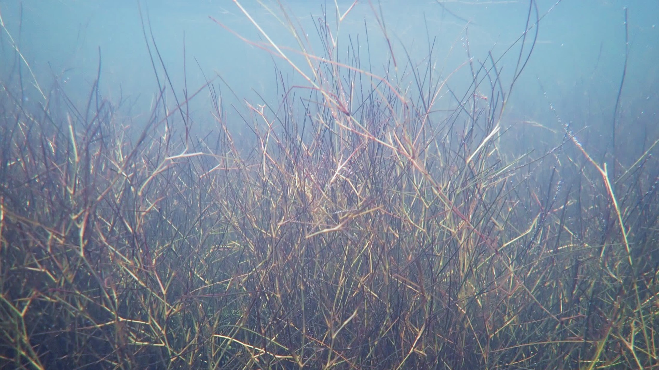
Ruppia megacarpa
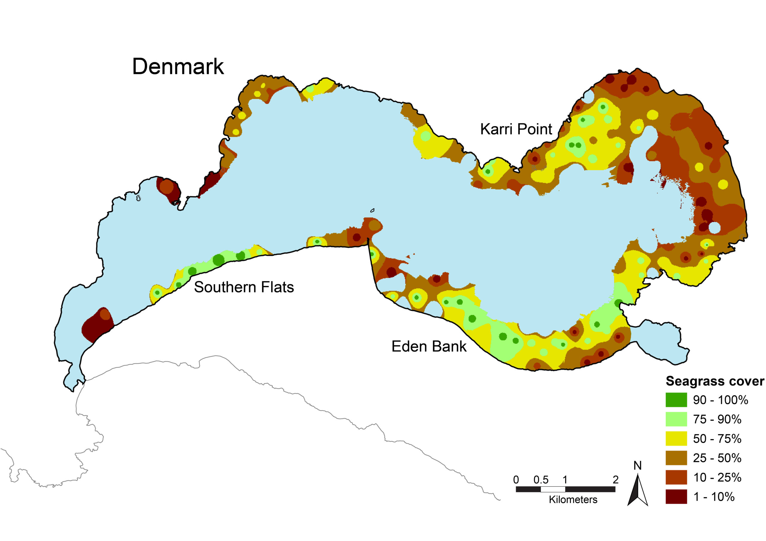
Seagrass distribution in Hardy Inlet
- Seagrass was first surveyed in the estuary in 1974 and 1975. Ruppia was present in the shallow waters throughout the lower and upper estuary, as well as in Swan Lake.
- The distribution of seagrass was similar in 2000. The density of seagrass coverage across most of the estuary was less than 10 per cent. The maximum density recorded was 60 per cent.
- Seagrass extent in 2008 increased to also include the lower basin. Coverage was generally sparse, but some meadows in the lower basin, around Thomas Island and west of Point Pedder, had high coverage (more than 75 per cent).
2022-23 monitoring
Seagrass was estimated to cover 452 hectares in January 2023, which is 45 per cent of the estuary area. Seagrass was present throughout the central basin and north of Point Ellis, close to the town of Augusta. Coverage was generally sparse, with a few isolated areas of high-density meadows west of Point Pedder, around Thomas Island and on the eastern side of the central basin. While the seagrass meadows have been present in North Bay and around Molloy Island in previous years, the extent of the meadows was reduced in January 2023. Seagrass continues to be absent in West Bay.
The average seagrass canopy height was 20 centimetres, with heights ranging between 5 and 40 centimetres. The abundance of small organisms growing on the seagrass leaves (epiphytes) was generally low across the estuary in January 2023.